LRDAS Coverage Study
Request A Demo Today
Please do not hesitate to contact us if you have any queries.
LRDAS Coverage Study
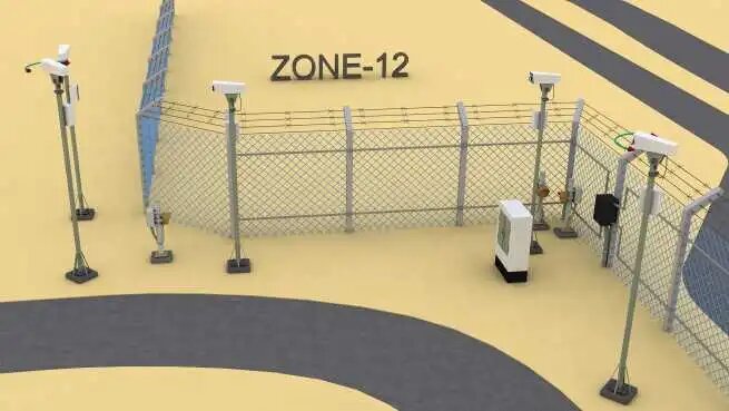
Long Range Detection & Assessment System (LRDAS) is a category of radar sensors and long-range cameras that keep an eye on activities near or on important infrastructure regions including airports, seaports, military bases, international borders, oil & gas refineries, and other key industries, among others. Given that it has capacities ranging from a few hundred meters to more than 10 kilometers, the LRDAS is recommended in situations where long-range surveillance is necessary. The time available to respond to possible threats is increased since incursion is detected from a great distance, allowing employees to recognise the problem and make a security choice before it reaches the boundary. Using the most cutting-edge monitoring and sensor technologies available, AARMTech helps in stopping issues before they start, and we're always working to improve our security design procedure. Our objective is to offer a completely integrated, end-to-end solution that offers creative answers to emerging threats and technologies, regardless of the scope and complexity of the project.
How we conduct Long Range Detection & Assessment System (LRDAS)
This section briefly outlines the methodology that was utilised to carry out the RADAR coverage analysis.
- Before conducting the site survey collect all the necessary drawings and documents such as Plant layout drawings, Existing RADAR location details, RADAR installation height, beam width, tilt, coverage etc.
- Conduct the site survey and verify & record existing RADAR system details.
- Conduct the feasibility study for new RADAR locations to be proposed by visually inspecting the area and record-all the newly built environment such as buildings and storage tanks etc. that may obstruct the visibility,
- Visually inspected data shall be taken into consideration while simulating the visibility analysis tool with google map support, since google map could not be updated with newly built environment obstructions.
- Simulate the Visibility analysis tool for existing RADAR area coverage by inputting data such as radar coverage range, beam width, target object height, etc. and record the output.
- Visually inspected data shall be taken into consideration while simulating the visibility analysis tool with google map support, since google Maps could not be updated with newly built environment obstructions.
- Simulate the Visibility analysis tool for existing RADAR area coverage by inputting data such as radar coverage range, beam width, target object height etc. and record the output.
- Repeat the simulation by changing the installation location, RADAR height and tilt etc., and by taking into consideration of newly built environment obstructions.
- Record only those simulated outputs which do not have continuous blind spot areas.
- Select the RADAR locations from the recorded output which cover maximum project area with the least blind spot.
- If the Terrain or the built environment with a single RADAR may obstruct visibility and not meet the project requirement, repeat the simulation for multi-RADAR with different locations. The “shadow” cast by an obstruction from the perspective of one RADAR or camera may be covered by another RADAR or camera.
- Export the selected simulated visibility analysis tool output to Google Earth Pro.
- Simulate the Google Earth pro tool for Elevation details by adding ‘PATH’ which goes through the blind spot area of the RADAR. Record the result.
The tool we use for Long Range Detection & Assessment System (LRDAS)
The software used to prepare the Rada Coverage study is SPx and Google Earth Pro. SPx RADAR Coverage Tool uses a combination of terrain information and line-of-sight calculations to estimate the visibility of targets at given heights, as seen by RADARs at user-specified locations. Because the tool is using geometric line-of-sight calculations, the coverage map generated may equally apply to optical sensors located at the same sites.
Radar Coverage Study
Shuttle RADAR Topography Mission (SRTM) terrain data is used to calculate the RADAR visibility. This dataset covers the whole world, with a resolution of approximately 30m. Additionally, the professional version of the software includes support for using DTED data files as the source of terrain data. For even higher definition requirements, for example airport installations or camera security projects, a special version of the software is available that provides GeoTIFF data support. RADAR Coverage Tool Geo supports the use of GeoTIFF digital surface model (DSM) data, which may have sub-meter elevation data spacing.
SPx RADAR Coverage Tool allows RADAR coverage information to be calculated for up to 10 RADAR sites, simultaneously, and for the resultant coverage map to be exported to a KML file. This enables the coverage map data to be displayed in third party GIS systems that support KML format, such as Google Earth.